
How magnetotellurics works
Magnetotellurics (MT for short) is a remote sensing technique that can image the earth's electrical resistivity structure from depths of a few 100 metres to several 100 kilometres. Natural electromagnetic (EM) waves are generated in the Earths atmosphere and magnetosphere by a range of physical mechanisms. The basic physics is illustrated below.
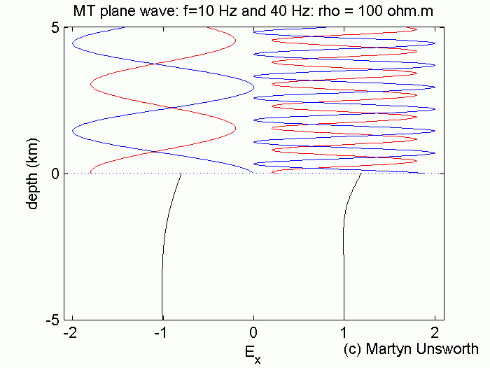
These EM waves travel downwards (blue) to the Earth's surface and most of the energy is reflected upwards (red). Some energy enters the Earth and diffuses downwards. The depth of penetration in the Earth is controlled by the skin depth phenomena. Depth of penetration decreases as the EM signal frequency increases.
By measuring the horizontal electric and magnetic fields at the earth's surface, and then going through some tortuous mathematics, we can measure the electrical resistivity of the Earth as a function of depth.
The EM signals at different frequencies originate through the following mechanisms:
- High frequency signals originate in lightning activity (f > 1 Hz)
- Intermediate frequency signals come from ionospheric resonances (1 Hz > f > 0.01 Hz)
- Low frequency signals are generated by variations in the solar wind (0.1 Hz > f > 0.00001 Hz)
For more details and derivations see section C4 of my notes for Geophysics 424 at the University of Alberta.
The electrical resistivity can then be interpreted, guided by resistivity measurements made in the laboratory and other fields observations, such as surficial geology. In general, rocks containing fluids such as water will have a low resistivity. Similarly, dry and cold rocks will have high resistivities.
Back to the Martyn Unsworth's homepage