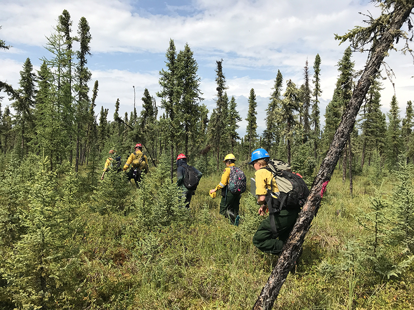
Planning for wildfires at the community level can include strategic FireSmart treatment, like at this area near Conklin, Alta. Photo courtesy of Jen Beverly.
Jen Beverly has an admittedly unique take on wildfire research. After working for years figuring out ways to predict where and when fires might happen, she has turned her attention to planning for what's possible - and there's a lot possible.
Whenever you have fuel and an avenue for ignition, there is potential for fire.
"I've moved away from trying to predict when and where fires will happen," said Beverly, an assistant professor (wildland fire) in the Faculty of Agricultural, Life & Environmental Sciences. "I think it's what's possible that counts. If fire is possible in an area, then let's plan for it."
So how do you plan for wildfires?
There are scales of planning - your home, a community, the landscape - and each one is different.
For the home, FireSmart offers an assessment that takes homeowners through everything from roofing materials and gutters to landscape features. You can also find evacuation tips and planning tools on their website.
Beverly's research, however, goes beyond the individual home and looks at the bigger picture. Her work at the community scale led to the creation of a planning tool to help communities mitigate the effects of wildfires.
FireSmart Wildfire Exposure Assessment (WEA), inspired by a 2010 paper co-authored by Beverly, helps communities identify locations exposed to potential ignition from wildfire as well as fuels (any vegetation capable of generating ignitions) that cause these exposures. In other words, is your neighbourhood at risk of igniting from falling embers if a wildfire happens within 100 metres? (This is one of many possible scenarios.) Beverly worked with the Alberta Wildfire Management Branch and FireSmart Canada to produce a non-technical guidebook that explains how WEA works.
When it comes to wildfire threats to communities, you need to consider values, receptivity, exposure and ignition.
Values: values are anything of worth, including homes, commercial buildings and critical wildlife habitat.
Receptivity: a value that can burn in considered receptive. A concrete building, for example, is not receptive, while a house with wood shingles is receptive.
Exposure: are hazard fuels in range? Hazard fuels are those that throw embers or produce intense heat when they burn. Evergreens, especially black spruce, are a common hazard fuel that burns easily and intensely.
Ignition: when a wildfire enters a community, it uses one of three possible avenues: direct flame; radiant heat; or ember transport. Contact with direct flame is limited to very short distances. Radiant heat and embers have longer ranges and are the focus of WEA. WEA determines a value's exposure to radiant heat (within 30 metres) and high densities of embers that can occur up to 500 metres from an encroaching wildfire.
A value must be receptive and exposed to be considered at risk of ignition. For example: a concrete lot with no surrounding vegetation is low value, not receptive and has no hazard fuels nearby, so it wouldn't be threatened by wildfire. Wood houses in a densely forested neighbourhood are high value, receptive and have hazard fuels nearby, making it highly possible they would burn in a wildfire.
This is why WEA results need to be combined with other information to evaluate risk. The FireSmart Home Assessment determines receptivity to ignition and WEA determines if there is exposure to possible ignition from nearby hazard fuels. Exposed areas are wildfire entry points into the community, making them a priority for mitigation efforts.
Beverly's research helps communities plan ahead for wildfires. She's interested in improving evacuation routes, helping fire managers decide which fires to focus on when resources are limited, and figuring out how to better map and manage hazard fuels. Once hazard fuels are known, they can be thinned or removed, isolated with fire breaks, or replaced with fire-resistant species.
"We may not know where or when a wildfire will start, but we know where fuels are and we know how they burn," said Beverly.
Communities can have assessments completed by trained experts - independent consultants or government analysts.
Looking ahead, Beverly is working on a new tool to assess hazard fuels out to 10 kilometres around a community. "These tools aren't complex modelling, but they're simple and easy for communities to use," said Beverly. "This is a huge departure from what most fire researchers are doing, but it cuts to the chase."
Landscape tips to keep your home safer
Fire-resistant plants: alders, ash, aspen, birch, cherry, cottonwood, maples (avoid cedar, juniper, pine, tall grass, fir, cedar and spruce)
Maintain a 1.5-metre non-combustible zone around your home
Choose plants for your hardiness zone
Consider rock mulch over bark and pine needle mulch, especially within 10 metres of your home
A well-maintained lawn can serve as an effective fire break - keep grass shorter than 10 cm
Plant a few fire-resistant plants and shrubs within 10 metres of your home and nothing else
Other considerations: tree pruning, plant water requirements and xeriscaping
Fact: 50 per cent of the homes that burn from wildfires are started by sparks and embers
Fact: 60 per cent of wildfires are caused by humans
Protect your home
Roof - use class A fire-rated roof materials such as metal, asphalt, clay and composite rubber tiles
Chimney - use a spark arrester
Gutters - keep them clean
Siding - untreated wood and vinyl siding offer little wildfire protection
Windows - choose tempered, double-panel
Doors - ensure they are fire-rated and have a good seal
Firewood - wood piled against a house is a fire hazard, so keep your firewood at least 10 metres away
Burn barrels - place these as far from your home as possible, use a six-millimeter or finer wire mesh screen, and keep the area within three metres of the barrel clear of combustible material
Fire pits - check with your local municipality for permit and safety regulations