CIRUS UAV
23 August 2021
Large-scale flooding events are on the rise across the world. Alberta itself has seen several flooding disasters in recent years, most notably in Calgary in 2013 and more recently in Fort McMurray. And, while we are learning from our responses to those events, the clear preference is to safeguard our infrastructure before disaster strikes.
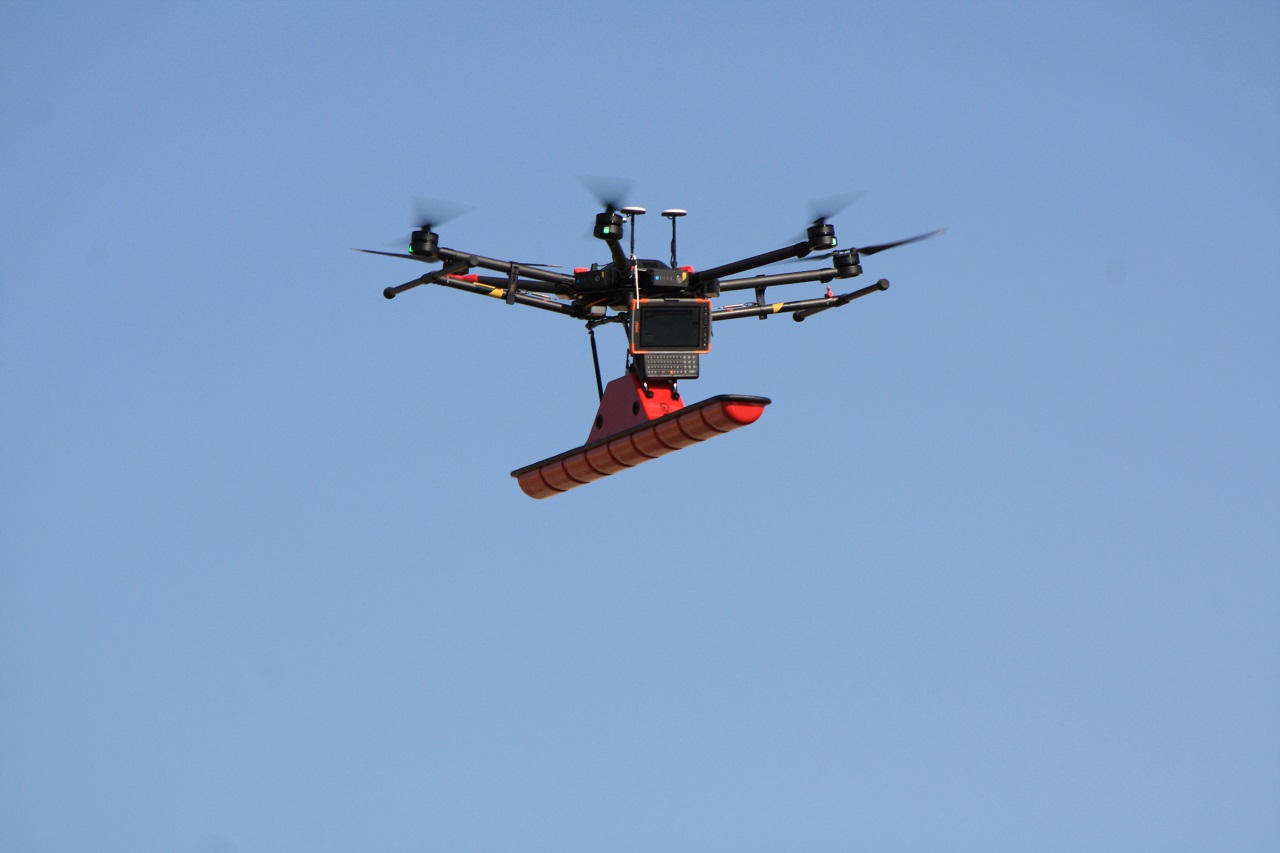
Dr. Ken Whitehead and the CIRUS research team at SAIT see Unmanned Aerial Vehicles (UAVs) as a key piece of technology to help planners determine vulnerability to flooding. Using high-resolution Light Detection and Ranging (LiDAR) and Ground-Penetrating Radar (GPR) transported by the UAVs, the project seeks to map floodplains and riverbed depths in flood-prone areas that will help calibrate provincial hydrological models and identify infrastructure at risk from flood events.
The CIRUS researchers are also testing the applicability of this technology for river bottom surveys. They have already successfully demonstrated the concept on the Bow River and hope to try it at an operational scale using Beyond Visual Line of Sight (BVLOS) UAV flight in the coming year. “It’s really exciting,” enthuses Dr. Whitehead, an expert in UAVs and drones for the environment. “This is a new application for UAVs, where we are now able to fine-tune and improve the precision of regional hydrological models and also identify infrastructure at risk of being impacted during flooding events. CIRUS was able to fly the first UAV-mounted GPR system in North America as part of this project. Alberta is taking a leading role in this important application.”
And, like much of our work at ASI, this project is made possible through key collaborations. Industry partner Earth Scan Technologies has provided the GPR sensors, and the Alberta Government is assisting the research team in identifying the province’s critical areas prone to flooding.
The team is gearing up for Summer 2021 when they will carry out multiple data collections along sections of the Bow River and develop algorithms for integrating the LiDAR and GPR data to facilitate the Government of Alberta to fine-tune provincial hydrological models. They will then begin developing an infrastructure vulnerability database, including floodplain and riverbed mapping, and aim to test the methodology at operational scales in the Summer of 2022 by surveying a section of the Athabasca River near Fort McMurray.
With the improvement in provincial hydrological modelling and flood prediction, the Government of Alberta, along with local and municipal governments, will benefit from improved flood prediction and the identification of infrastructure at risk. But ultimately, the real beneficiaries will be developers and industry looking to find suitable and safe locations for site development. “In the future, UAV-mounted and in-situ sensors will become commonplace for monitoring natural disasters, such as flood events,” says Dr. Whitehead. “This will allow stakeholders at all levels to make informed decisions on the location of new developments and critical infrastructure.”
Having this knowledge in hand makes a more secure future for all Albertans.
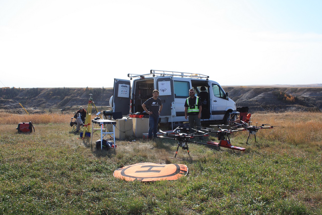
The CIRUS team at SAIT, led by Dr. Ken Whitehead, includes Shahab Moeini (M.Sc.), Operations manager; Rick Duchscher, Instructor and UAV pilot; Sara Ashoori (M.Sc.), Field data acquisition specialist GIS modeller; Alireza Mardan, Assistant UAV pilot and hardware specialist.